From the ground station in Ankara RASAT The Institute, which provides a total of 40 minutes of communication for 10 minutes 4 times a day, has started two-dimensional land modeling studies. The Institute will also carry out three-dimensional land modeling of Turkey next year.
Public institutions will be able to view these maps instantly, receive up-to-date image orders and download the desired images free of charge through a web-based interface to be developed with local software.
Within this framework, it is planned to cover Turkey and its immediate surroundings with 7.5 meter resolution RASAT satellite images by October 2012. In 2013, stereo imagery will be acquired and a 7.5 meter resolution Digital Terrain Model of Turkey and its immediate surroundings will be obtained.
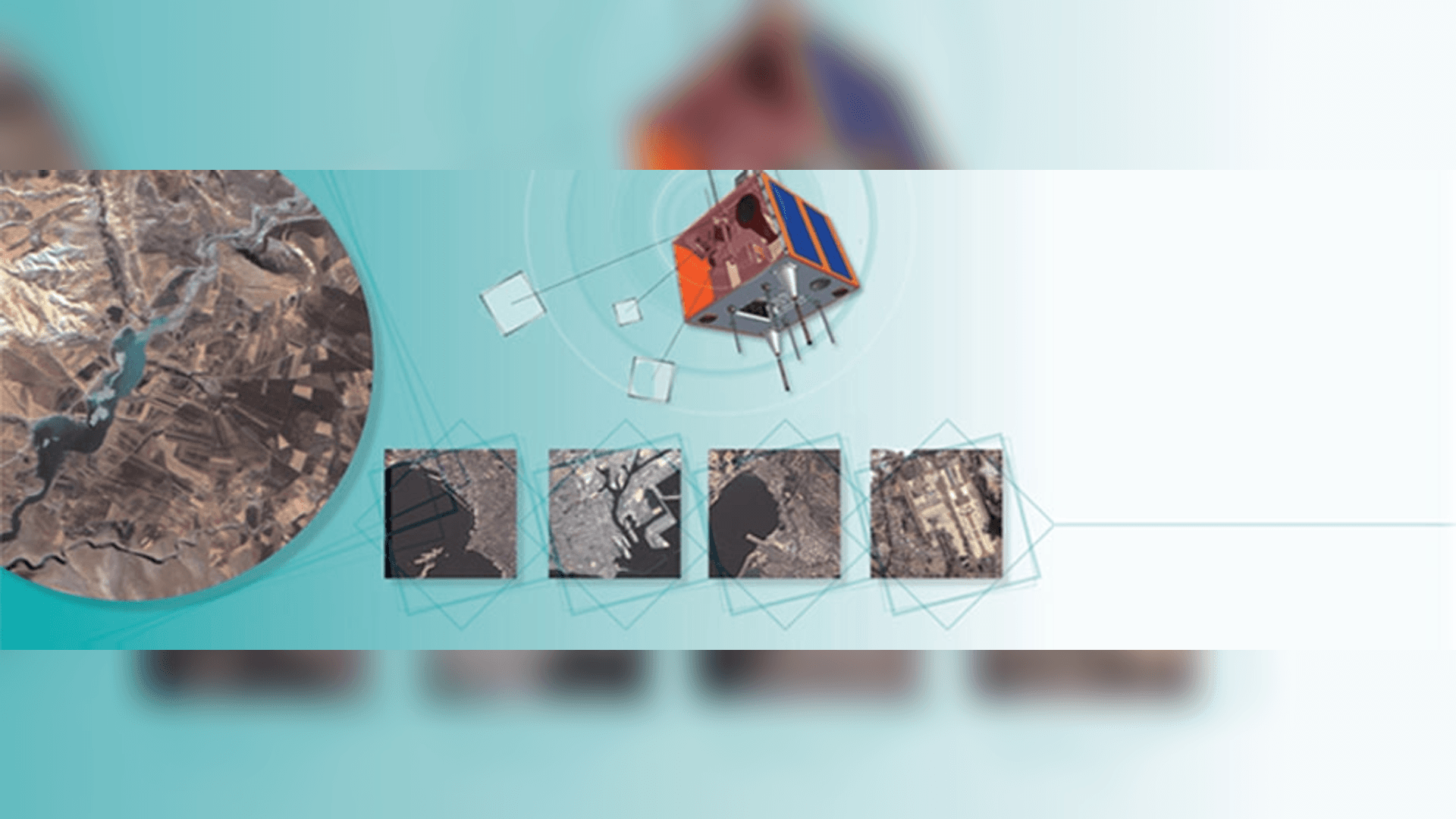
The RASAT satellite has the capability to take mono and stereo images of any part of the world. Of the 100 images obtained with RASAT so far, 90 are experimental and 10 are public orders. Of these images, 25 are domestic and 75 are from abroad. The images are planned to be used for urban and regional planning, forestry, agriculture, disaster management and similar purposes.
In order to promote RASAT, a workshop will be organized for public institutions in October 2012.
Approximately 1200 RASAT satellite images, which will cover Turkey, will be made available to public institutions and organizations as the basic underlying data of Turkey's National Geographic Information System.
RASAT Satellite and Image Characteristics
- The RASAT satellite is 687 km high and weighs 93 kg.
- It has 7.5 meters B&W and 15 meters color resolution.
- One square image covers an area of 900 km2 (30kmx30km).
- One frame image file size is 28.9MB.
- The satellite data storage unit can store 32 square images. With the new software to be installed in April, the memory will be doubled.
- A square image can be downloaded in 160 seconds with S band and 4 seconds with X band.
- It is possible to communicate from Ankara 4 times a day for 10 minutes each for a total of 40 minutes.
- The average time to reimage the same spot is 2.5 days.
RASAT Satellite production is aimed to be as indigenous as possible.
- The targeted indigenization rate for software is and the rate of achievement of this target is . This indigenization target was calculated by weighting 64 different software components according to their critical importance.
- The targeted localization rate for Hardware Design is and the rate of achievement of this target is .
- The targeted localization rate for Hardware Production is and the rate of achievement of this target is .