UZAY
Mission Control Software
Mission Planning Software
(Global Positioning System Low Noise Amplifier)
It is used for pre-transit planning of the missions to be performed by imaging satellites. After the evaluation of user requests, shooting opportunities are calculated and imaging and download plans are prepared:
- Evaluation of imaging requests from the request system
- Calculation of shooting opportunities, creation of imaging plan
- Calculating location, time and satellite orientation for planned shots
- Preparing a download plan for downloading image data
Making the plans ready for satellite transmission with the procedure
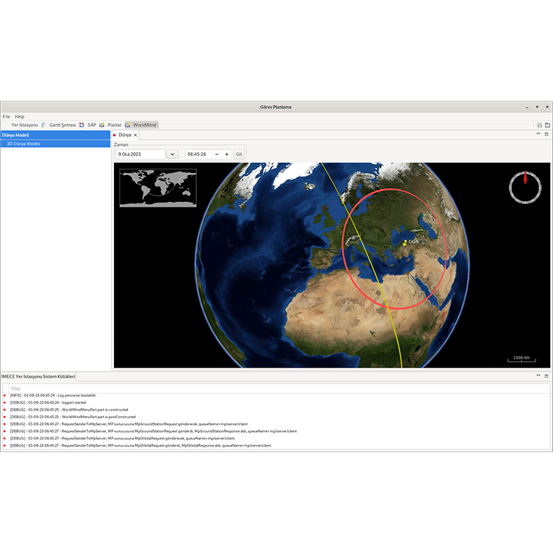
Task Scheduling Software Features
Key Features
- Receiving viewing requests from the request system where user requests are collected
- Feasibility and conflict analysis for image requests
- Assessment of shooting suitability using meteorological data
- Frame image planning
- Lane image planning
- Wide area image planning
- Stereo image planning
- Nominal imaging plan preparation
- Preparation of an emergency imaging plan
- Calculation of location, time and satellite orientation for planned shots
- Determination of shooting configurations
- Satellite memory occupancy model tracking
- Visualization of satellite orbit, satellite position in orbit and ground station communication cone
- Preparation of a plan for downloading image data to the ground station for planned missions
- Preparation of input files to procedures for submission of plans to satellite
Installation / Configuration
Task-specific customization through the use of an independent task database
Operation as single, cold or hot redundant
Server-client architecture, multi-client usage
User management and authorization
Linux operating system usage
Task-oriented customization with microservice architecture
Command and Control Software
(Global Positioning System Low Noise Amplifier)
It provides communication with satellite or spacecraft through ground station equipment. It is used for health status monitoring and control, loading of missions to be performed, execution of real-time operations and retrieval of payload data:
- Tracking platform and payload health information
- Loading of tasks
- Receipt of payload data
- Platform and payload maintenance operations
- Defining spatial measurement data structures
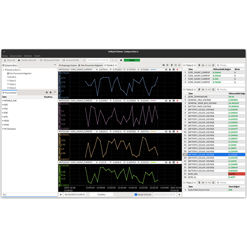
Command and Control Software Features
Key Features
- Communication with baseband units with CORTEX compatible communication interface
- Space command/space measurement communication with satellite/spacecraft in CCSDS standard
- Implemented CCSDS Protocols:
- Space Data Link Transfer Frame
- Space Packet
- COP1
- CFDP
- Defining and editing uzkomut/uzmometers with the Task Database interface
- Preparing and sending uzcommands to be executed in real time
- Preparation and sending of fixed or relative time special command lists to be operated at a later date
- Uzkomut submission process tracking, archiving, querying from archive
- Real-time spatial reading and processing, archiving
- Spatial representation with alphanumeric tables, sorted tables and worksheets
- Spatial representation with time dependent and X-Y graphs
- Spatial display with simulation screens with animated visual elements
- Display of archived spatial measurements with real-time data
- Automation procedure operation prepared with Python language
- Process tracking and reporting in procedure operation
- Two-way file transfer with CFDP protocol
- Long-range encryption and decryption, key management
- Monitoring of out-of-limit measurements, alarm generation
- Receipt and recording of Payload Data
Installation / Configuration
Task-specific customization through the use of an independent task database
Operation as single, cold or hot redundant
Server-client architecture, multi-client usage
User management and authorization
Use with Linux operating system
Task-oriented customization with microservice architecture
Orbit Control Software
(Global Positioning System Low Noise Amplifier)
Orbit Control Software enables the determination and advancement of the orbits of satellites and spacecraft and the planning of orbital operations. It performs orbit determination, advancement, maneuver calculation and verification.
- Trajectory determination with KKS, TLE and distance measurement data
- Orbit advancement and celestial lunarity calculation
- Calculating future and past trajectory information
- Forecast of rainfall events
- Orbit raising maneuver planning
- Position protection maneuver planning
- Planning a co-location maneuver
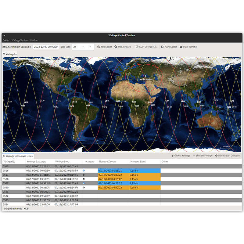
Trajectory Control Software Features
Key Features
- Orbit determination for low earth orbit satellites with CDS and TLE data
- Orbit determination with distance measurement results for geostationary satellites and deep space missions
- Trajectory advancement, adding/subtracting planned or past maneuvers
- Forecasting of celestial events, solar-Earth, solar-moon eclipses, communication disruptions
- Propulsion system performance model usage and calibration
- Orbit raising maneuver planning
- Planning latitude and longitude maneuvers for position protection
- Target trajectory and time calculation for maneuver, maneuver verification
- Planning co-location maneuvers to interoperate with other satellites in the same location
- Fuel consumption calculation and life estimation
- Calculation of Ground Station transits
- Evaluating collision warnings by processing CDM data
- CCSDS OPM orbit data file preparation for use in similar software
- Preparing a procedural output for the operation of planned maneuvers
Installation / Configuration
Operation as single, cold or hot redundant
Server-client architecture, multi-client usage
User management and authorization
Use with Linux operating system
Task-oriented customization with microservice architecture
Image Processing Software
(Global Positioning System Low Noise Amplifier)
It is used for processing the image data obtained as a result of the missions performed by imaging satellites up to Level 2. Decryption, decompression, radiometric calibration and geometric calibration of the images are performed. The processed images are transferred to an independent catalog system.
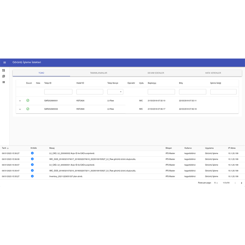
Image Processing Software Features
Key Features
- Decryption of images
- Obtaining Level 0 data by decompressing the images
- Obtaining Level 1 data with radiometric correction
- Image fusion according to detector structure
- Obtaining Level 2 data by applying geometric correction with precise orientation data from satellite
- Image processing can be distributed between main and worker servers
- Creating JPEG2000, GeoTIFF and NITF image files
Generating AOI, RPC and DIMAP data - Transferring the processed images to the Image Catalog System
Installation / Configuration
Algorithm integration with modular architecture
Dynamically add and remove worker servers
Server-client architecture, multi-client usage
User management and authorization
Use with Linux operating system
Archive and Analysis Software
(Global Positioning System Low Noise Amplifier)
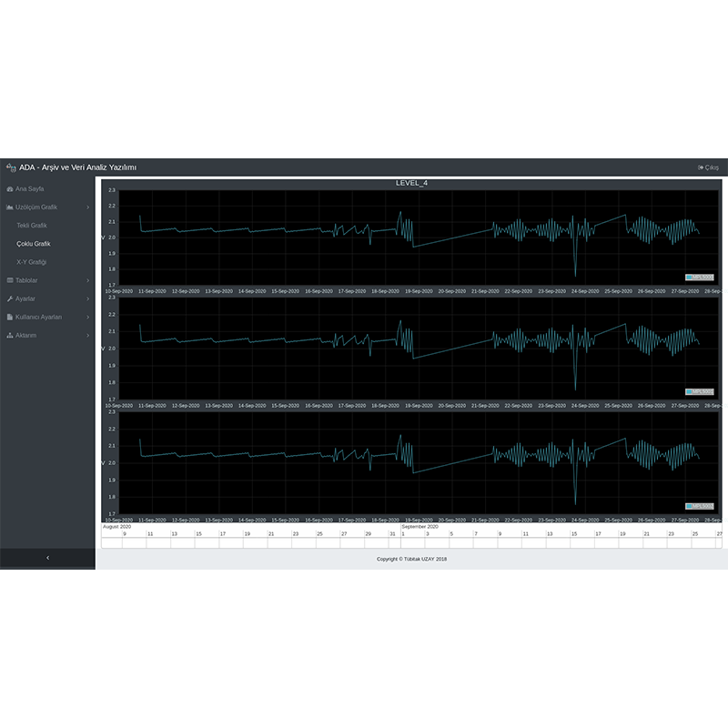
It archives the command-space measurement communication with the satellite/spacecraft through the Command and Control software in the database on a long-term basis. It creates statistical data by summarizing the archived space measurement data at various levels. It enables the archived data to be analyzed with graphs and tables.
Archive and Analysis Software Features
Key Features
- Uzkomut package archiving
- Spatial measurement package archiving
- Archiving of raw and processed values of the range parameter
- Archiving out-of-limit survey data
- System log archiving including event messages at information, warning and alarm levels
- Processing of spatial data and calculation of statistical data at various levels
- Data distribution to other software via message interface
- Spatial data representation with graphs and tables
- Tabular representation of uzcommand and uzmeasurement package data
- System log data display with tables
Installation / Configuration
- Open source relational database usage
- Common use for multiple satellite/spacecraft missions
- Task-specific customization with the use of an independent Task Database
- Hot redundant operation as standalone or active-active
- Server-client architecture, multi-client usage
- Record on server disks or NAS
- Linux operating system usage
Satellite Simulator Software
(Global Positioning System Low Noise Amplifier)
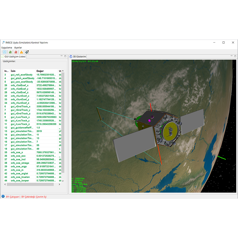
Simulates nominal and critical operations of satellites. It simulates the dynamic environment, runs the flight software and enables it to be controlled with ground software. Failure conditions are created and fault detection and debugging scenarios and critical operations are tested.
Satellite Simulator Software Features
Key Features
- Satellite and orbital dynamics models
- Satellite subsystem modeling
- Running real flight software
- Ground station modeling, data packaging and decoding
- Communication with command and control software
- Normal and accelerated use
- Scenario preparation, recording
- Scenario start, stop and restart
- Creating the initial state with satellite spatial data
- Create a fault condition
- 3D visualization of satellite orientation and orbit
- Use in operator training by creating a specific initial situation
- Data archiving and review
- Use with Linux operating system

