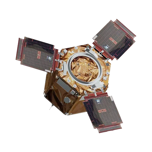
UZAY
GÖKTÜRK-2
![göktürk-logo-1](https://uzay.tubitak.gov.tr/wp-content/uploads/sites/132/2024/06/gokturk-logo-1.png)
![SBB AMBLEM](https://uzay.tubitak.gov.tr/wp-content/uploads/sites/132/2024/06/SBB_AMBLEM-300x.png)
![ae77e98d3c6abf23f41196ae91c2d82a](https://uzay.tubitak.gov.tr/wp-content/uploads/sites/132/2024/06/ae77e98d3c6abf23f41196ae91c2d82a.jpg)
Turkey's First National Military Intelligence Satellite
Project Goal
Customer Needs Driven Development
Altitude
686 km
Resolution
2.5 m Panchromatic / 5 m RGB
Mass
397 kg
Launch Date
December 18, 2012
Gains
- Advanced Infrastructure
- Satellite Equipment with New History
- Advanced Flight Computer
- Interface Cards
- Infrared Camera
- Human Resources
- High Resolution Satellite Development Capability
![gokturk-2-g-500X](https://uzay.tubitak.gov.tr/wp-content/uploads/sites/132/2024/06/gokturk-2-g-500X.png)