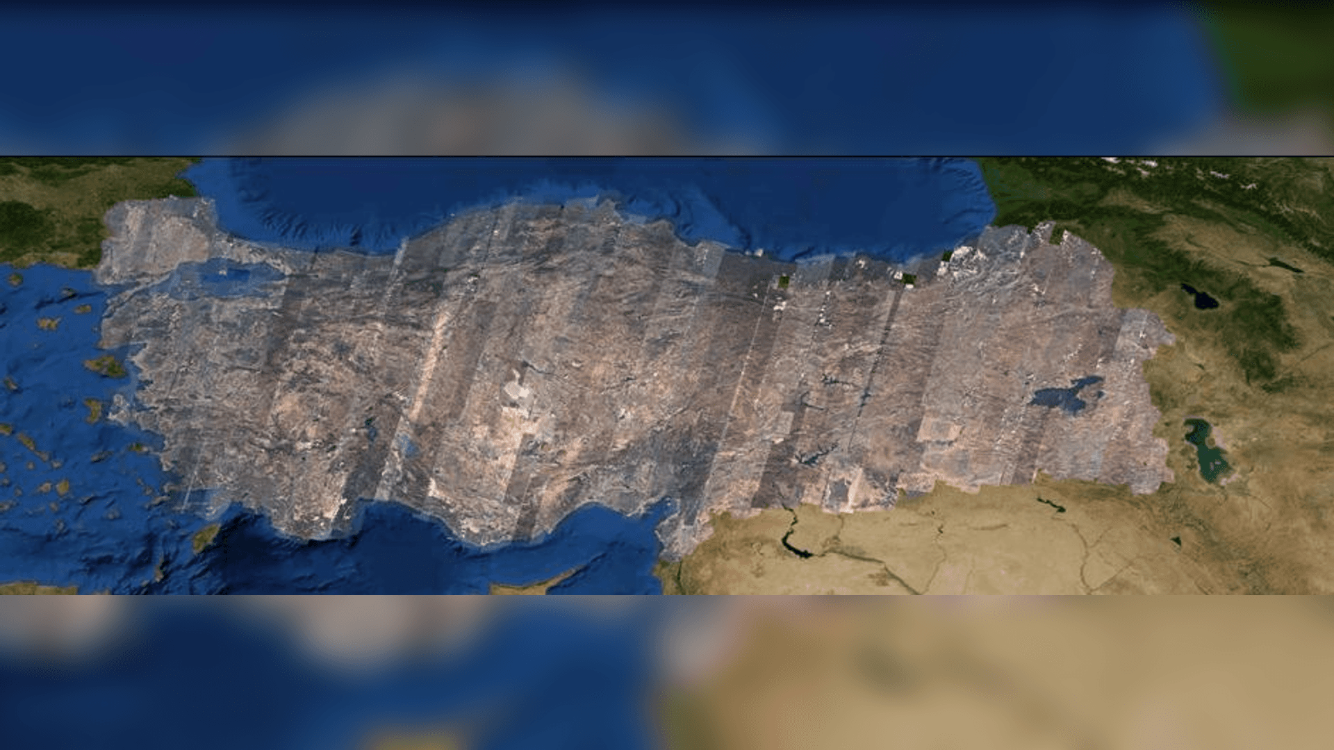
"Turkey Mosaic Image" was created by combining the images taken in 2012, 2013 and 2014 by RASAT, the first domestic earth observation satellite produced by TÜBİTAK Space Technologies Research Institute. More than 3000 30kmx30km RASAT satellite images were used to create the mosaic. The mosaic image was created in ecw (9 GB), jp2 (22 GB), tif (26 GB) and img (45 GB) formats. The image is shared free of charge with member users on "gezgin.gov.tr". The portal offers users the option to download files in different resolutions and formats.
RASAT has been taking images from all over the world since 2011. The satellite, which has a ground sampling distance of 7.5 meters in the panchromatic band and 15 meters in the red, blue and green bands, serves for purposes such as cartography, disaster monitoring, environmental monitoring and urban planning.
Launched on August 17, 2011, RASAT, the first national earth observation satellite, orbited 19,180 orbits for four years and imaged a total area of 7 million 380 thousand km2 . The images obtained by RASAT were made available to public institutions and universities on August 19, 2014 as part of the "Geoportal Project" launched by TÜBİTAK UZAY with the support of the Ministry of Development.